Harvey Flood Data

We are keenly aware from TV news, social media and conversations with friends and family that Hurricane Harvey brought "old testament" style flooding to Texas and southwest Louisina. Lynn Dupont, who serves as the principal planner and GIS coordinator at the New Orleans Regional Planning Commission, has shared several links to online GIS web maps and data portals which provide documentation of the damage. This may be of use to public sector planners in the Lake Charles region and to private-sector practicioners who find themselves involved in disaster recovery work.
The University of Texas' MOVES data viewer (pictured above) [http://magic.csr.utexas.edu/public/views/] is a portal providing links to numerous data sets including collections of high resolution, oblique air photos by the Civil Air Patrol (see Tx CAP Sortie data), river gauges data, rainfall totals, vairous raster imagry layers, and flood extent layers.
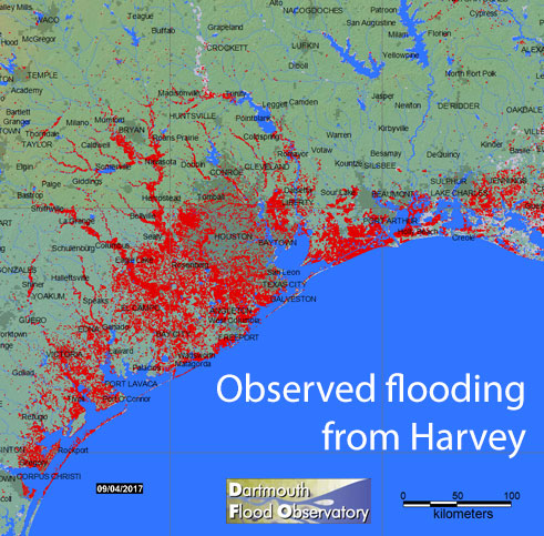
The University of Colorado's Dartmouth Flood Observatory site offers an online viewer and also downloadable raw data as a geotiff and also as shapefiles sets.
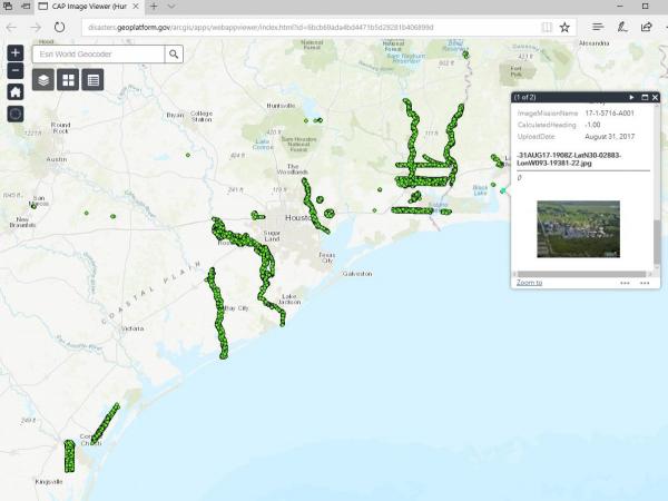
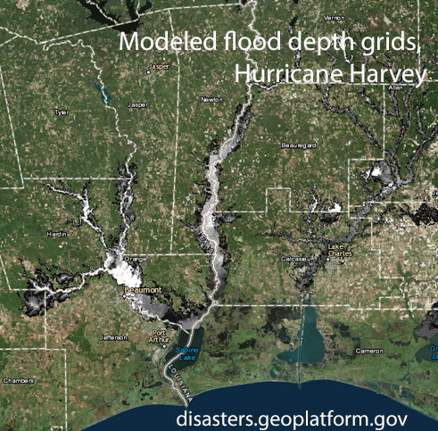
Geoplatform.gov offers Civil Air Patrol imagery and modeled depth grids from Harvey through an ArcGIS viewer interface.
Thanks to Lynn Dupont for forwarding these data sources to us and we hope they will be of use to our members.


