Sections
Local Sections
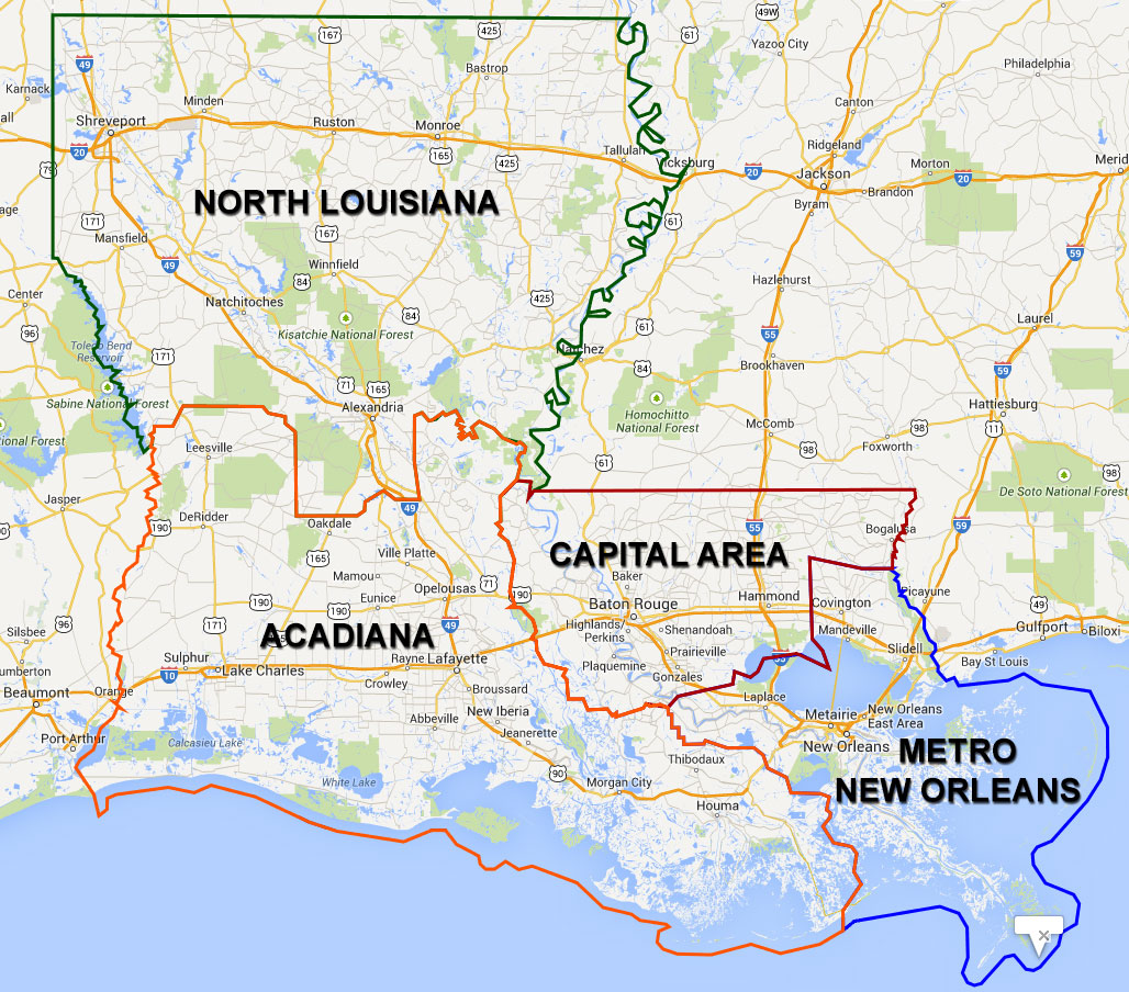
Louisiana is divided into four sections, corresponding with local member groups as illustrated above. Each local section has regular meetings and functions to foster professional development and volunteerism. Click on a Section page below to learn more.
Acadiana
 The Acadiana Section comprises southwest Louisiana from the Atchafalaya Basin to the Texas state line. This "Cajun heartland" of our state includes Lake Charles, Lafayette, and Houma-Thibodaux metropolitan areas, as well as many smaller rural communities. The agriculture and seafood industries are prominent. Major planning concerns in Acadiana include land loss and subsidence along the coast, a planned new interstate highway linking Lafayette to New Orleans, anticipated spectacular growth of the petro-chemical industry around Lake Charles, and investments by our nation's armed forces in Fort Polk.
Capital
 The Capital Section includes greater Baton Rouge and most of the Florida Parishes. In addition to being the seat of state government, the Baton Rouge metro area includes two universities, cutting-edge health care facilities, major petro-chemical installations, and the highest population concentration in the state. Transportation continues to be a challenge in urban areas, but rural communities to the north and east where timber production was once the dominant economic engine exhibit a far different character. Flooding is a concern in riverine and lakeshore areas during storms. Significant growth in many of these parishes complicates the environmental and development issues they face.
Metro New Orleans
 Ask any planner and they will say "It ain't always easy in The Big Easy..." The Metro New Orleans Section is rebounding and rebuilding from the catastrophic flooding caused by Hurricane Katrina. The salient trait of metro New Orleans is its dense urban fabric of older neighborhoods. Other areas, however, are more suburban in character and are facing the same aging infrastructure challenges as the rest of the state. As a cultural mecca - offering music, cuisine, and activities to suite any palette - New Orleans is also home to our flagship planning school at UNO, to professional athletic teams, and to maritime interests. The Metro New Orleans Section also includes the North Shore communities of Slidell, Mandeville and Covington. Life on the North Shore is markedly different from New Orleans proper, and key planning issues include economic development, rural character preservation, and retirement living.
North Louisiana
North Louisiana is geographically our largest Section and includes the metropolitan areas of Shreveport-Bossier City, Monroe, Alexandria, and many smaller communities such as Ruston and Natchitoches. There is no denying that north Louisiana is different from the south: climate, geology, population, and to some extent the economy are distinct. Agriculture and natural gas extraction are significant industries, as is health care and education. Large expanses are preserved as national forests and state preserves, creating welcome buffers between urbanized areas. Transportation continues to be an important planning theme in North Louisiana with the near-term completion of I-49 strengthening the connection to Arkansas, and with potential passenger rail service linking Shreveport and Monroe to Dallas and Jackson. How will these projects affect growth in these communities? Planners are at the forefront of this discussion.


